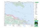
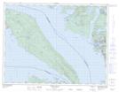
Maps showing South Texada Island Park, Texada Island Land District, British Columbia
South Texada Island Park is a Conservation area located in Texada Island Land District, British Columbia.
- Latitude: 49° 30' 45'' North (decimal: 49.5125000)
- Longitude: 124° 10' 0'' West (decimal: -124.1666698)
- Topography Feature Category: Conservation area
- Geographical Feature: Provincial Park
- Canadian Province/Territory: British Columbia
- Location: Texada Island Land District
- Atlas of Canada Locator Map: South Texada Island Park
- GPS Coordinate Locator Map: South Texada Island Park Lat/Long
South Texada Island Park NTS Map Sheets