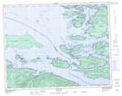
Maps showing Meem Quam Leese, Range 1 Coast Land District, British Columbia
Meem Quam Leese is a Unincorporated area located in Range 1 Coast Land District, British Columbia.
- Latitude: 50° 37' 10'' North (decimal: 50.6194000)
- Longitude: 126° 34' 30'' West (decimal: -126.5749999)
- Topography Feature Category: Unincorporated area
- Geographical Feature: Locality
- Canadian Province/Territory: British Columbia
- Location: Range 1 Coast Land District
- Atlas of Canada Locator Map: Meem Quam Leese
- GPS Coordinate Locator Map: Meem Quam Leese Lat/Long
Meem Quam Leese NTS Map Sheets