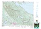
Maps showing Cameron Lake Park, Cameron Land District, British Columbia
Cameron Lake Park is a Conservation area located in Cameron Land District, British Columbia.
- Latitude: 49° 17' 15'' North (decimal: 49.2875000)
- Longitude: 124° 37' 10'' West (decimal: -124.6194000)
- Topography Feature Category: Conservation area
- Geographical Feature: Provincial Park
- Canadian Province/Territory: British Columbia
- Location: Cameron Land District
- GPS Coordinate Locator Map: Cameron Lake Park Lat/Long
Cameron Lake Park NTS Map Sheets