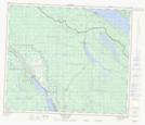
Maps showing Wet'suwet'en Village, Range 5 Coast Land District, British Columbia
Wet'suwet'en Village is a Unincorporated area located in Range 5 Coast Land District, British Columbia.
- Latitude: 54° 19' 40'' North (decimal: 54.3277999)
- Longitude: 125° 53' 00'' West (decimal: -125.8832999)
- Topography Feature Category: Unincorporated area
- Geographical Feature: Community
- Canadian Province/Territory: British Columbia
- Location: Range 5 Coast Land District
- Atlas of Canada Locator Map: Wet'suwet'en Village
- GPS Coordinate Locator Map: Wet'suwet'en Village Lat/Long
Wet'suwet'en Village NTS Map Sheets