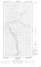
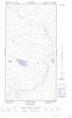
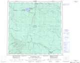
Maps showing Lake Carole, Peace River Land District, British Columbia
Lake Carole is a Lake located in Peace River Land District, British Columbia.
- Latitude: 59° 23' 20'' North (decimal: 59.3888890)
- Longitude: 123° 3' 30'' West (decimal: -123.0583330)
- Topography Feature Category: Lake
- Geographical Feature: Lake
- Canadian Province/Territory: British Columbia
- Location: Peace River Land District
- Atlas of Canada Locator Map: Lake Carole
- GPS Coordinate Locator Map: Lake Carole Lat/Long
Lake Carole NTS Map Sheets