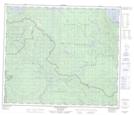
Maps showing Shas Dzuhl Koh Indian Reserve 35, Range 5 Coast Land District, British Columbia
Shas Dzuhl Koh Indian Reserve 35 is a Indian Reserve located in Range 5 Coast Land District, British Columbia.
- Latitude: 54° 29' 33'' North (decimal: 54.4925)
- Longitude: 124° 58' 42'' West (decimal: -124.9783298)
- Topography Feature Category: Indian Reserve
- Geographical Feature: Indian Reserve
- Canadian Province/Territory: British Columbia
- Location: Range 5 Coast Land District
- Atlas of Canada Locator Map: Shas Dzuhl Koh Indian Reserve 35
- GPS Coordinate Locator Map: Shas Dzuhl Koh Indian Reserve 35 Lat/Long
Shas Dzuhl Koh Indian Reserve 35 NTS Map Sheets