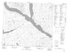
Maps showing Teh Noo'n Che Indian Reserve 49, Cassiar Land District, British Columbia
Teh Noo'n Che Indian Reserve 49 is a Indian Reserve located in Cassiar Land District, British Columbia.
- Latitude: 55° 4' 47'' North (decimal: 55.0797218)
- Longitude: 125° 33' 0'' West (decimal: -125.55)
- Topography Feature Category: Indian Reserve
- Geographical Feature: Indian Reserve
- Canadian Province/Territory: British Columbia
- Location: Cassiar Land District
- Atlas of Canada Locator Map: Teh Noo'n Che Indian Reserve 49
- GPS Coordinate Locator Map: Teh Noo'n Che Indian Reserve 49 Lat/Long
Teh Noo'n Che Indian Reserve 49 NTS Map Sheets