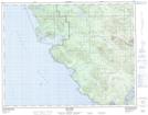
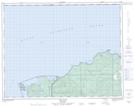
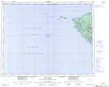
Maps showing Strandby River, Rupert Land District, British Columbia
Strandby River is a River located in Rupert Land District, British Columbia.
- Latitude: 50° 50' 20'' North (decimal: 50.8388888)
- Longitude: 128° 8' 50'' West (decimal: -128.1472222)
- Topography Feature Category: River
- Geographical Feature: River
- Canadian Province/Territory: British Columbia
- Location: Rupert Land District
- Atlas of Canada Locator Map: Strandby River
- GPS Coordinate Locator Map: Strandby River Lat/Long
Strandby River NTS Map Sheets