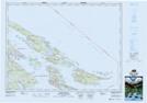
Maps showing Kadonaga Bay, Cowichan Land District, British Columbia
Kadonaga Bay is a Bay located in Cowichan Land District, British Columbia.
- Latitude: 48° 49' 9'' North (decimal: 48.8191669)
- Longitude: 123° 14' 35'' West (decimal: -123.2430548)
- Topography Feature Category: Bay
- Geographical Feature: Bay
- Canadian Province/Territory: British Columbia
- Location: Cowichan Land District
- Atlas of Canada Locator Map: Kadonaga Bay
- GPS Coordinate Locator Map: Kadonaga Bay Lat/Long
Kadonaga Bay NTS Map Sheets