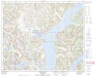
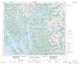
Maps showing Bluejay Falls, Range 4 Coast Land District, British Columbia
Bluejay Falls is a Falls located in Range 4 Coast Land District, British Columbia.
- Latitude: 53° 43' 56'' North (decimal: 53.7322229)
- Longitude: 129° 4' 50'' West (decimal: -129.0805559)
- Topography Feature Category: Falls
- Geographical Feature: Waterfall
- Canadian Province/Territory: British Columbia
- Location: Range 4 Coast Land District
- Atlas of Canada Locator Map: Bluejay Falls
- GPS Coordinate Locator Map: Bluejay Falls Lat/Long
Bluejay Falls NTS Map Sheets