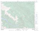
Maps showing Carol Lake, Lillooet Land District, British Columbia
Carol Lake is a Lake located in Lillooet Land District, British Columbia.
- Latitude: 50° 51' 35'' North (decimal: 50.8597218)
- Longitude: 122° 28' 10'' West (decimal: -122.4694448)
- Topography Feature Category: Lake
- Geographical Feature: Lake
- Canadian Province/Territory: British Columbia
- Location: Lillooet Land District
- Atlas of Canada Locator Map: Carol Lake
- GPS Coordinate Locator Map: Carol Lake Lat/Long
Carol Lake NTS Map Sheets