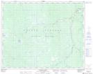
Maps showing A.M.R. Creek, Lillooet Land District, British Columbia
A.M.R. Creek is a River located in Lillooet Land District, British Columbia.
- Latitude: 51° 37' 9'' North (decimal: 51.6191669)
- Longitude: 123° 4' 30'' West (decimal: -123.0750000)
- Topography Feature Category: River
- Geographical Feature: Creek
- Canadian Province/Territory: British Columbia
- Location: Lillooet Land District
- Atlas of Canada Locator Map: A.M.R. Creek
- GPS Coordinate Locator Map: A.M.R. Creek Lat/Long
A.M.R. Creek NTS Map Sheets