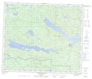
Maps showing Ihch'Az Uz Ta Tsoh 44, Range 5 Coast Land District, British Columbia
Ihch'Az Uz Ta Tsoh 44 is a Indian Reserve located in Range 5 Coast Land District, British Columbia.
- Latitude: 54° 35' 18'' North (decimal: 54.5883333)
- Longitude: 125° 7' 21'' West (decimal: -125.1225)
- Topography Feature Category: Indian Reserve
- Geographical Feature: Indian Reserve - Réserve indienne
- Canadian Province/Territory: British Columbia
- Location: Range 5 Coast Land District
- Atlas of Canada Locator Map: Ihch'Az Uz Ta Tsoh 44
- GPS Coordinate Locator Map: Ihch'Az Uz Ta Tsoh 44 Lat/Long
Ihch'Az Uz Ta Tsoh 44 NTS Map Sheets