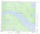
Maps showing Chundoo Lh'tan La 45, Range 5 Coast Land District, British Columbia
Chundoo Lh'tan La 45 is a Indian Reserve located in Range 5 Coast Land District, British Columbia.
- Latitude: 54° 34' 21'' North (decimal: 54.5725)
- Longitude: 124° 33' 46'' West (decimal: -124.5627776)
- Topography Feature Category: Indian Reserve
- Geographical Feature: Indian Reserve - Réserve indienne
- Canadian Province/Territory: British Columbia
- Location: Range 5 Coast Land District
- Atlas of Canada Locator Map: Chundoo Lh'tan La 45
- GPS Coordinate Locator Map: Chundoo Lh'tan La 45 Lat/Long
Chundoo Lh'tan La 45 NTS Map Sheets