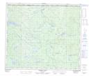
Maps showing Lhoh Cho 29, Range 5 Coast Land District, British Columbia
Lhoh Cho 29 is a Indian Reserve located in Range 5 Coast Land District, British Columbia.
- Latitude: 54° 46' 28'' North (decimal: 54.7744443)
- Longitude: 124° 12' 57'' West (decimal: -124.2158333)
- Topography Feature Category: Indian Reserve
- Geographical Feature: Indian Reserve - Réserve indienne
- Canadian Province/Territory: British Columbia
- Location: Range 5 Coast Land District
- Atlas of Canada Locator Map: Lhoh Cho 29
- GPS Coordinate Locator Map: Lhoh Cho 29 Lat/Long
Lhoh Cho 29 NTS Map Sheets