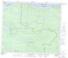
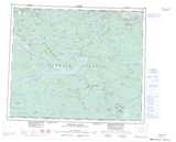
Maps showing Binta Lake Indian Reserve 2, Range 4 Coast Land District, British Columbia
Binta Lake Indian Reserve 2 is a Indian Reserve located in Range 4 Coast Land District, British Columbia.
- Latitude: 53° 51' North (decimal: 53.8577778)
- Longitude: 125° 26' West (decimal: -125.4358333)
- Topography Feature Category: Indian Reserve
- Geographical Feature: Indian Reserve
- Canadian Province/Territory: British Columbia
- Location: Range 4 Coast Land District
- Atlas of Canada Locator Map: Binta Lake Indian Reserve 2
- GPS Coordinate Locator Map: Binta Lake Indian Reserve 2 Lat/Long
Binta Lake Indian Reserve 2 NTS Map Sheets