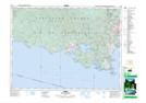
Maps showing T'Sou-ke Indian Reserve 1, Sooke Land District, British Columbia
T'Sou-ke Indian Reserve 1 is a Indian Reserve located in Sooke Land District, British Columbia.
- Latitude: 48° 23' 10'' North (decimal: 48.3861111)
- Longitude: 123° 41' 47'' West (decimal: -123.696389)
- Topography Feature Category: Indian Reserve
- Geographical Feature: Indian Reserve
- Canadian Province/Territory: British Columbia
- Location: Sooke Land District
- Atlas of Canada Locator Map: T'Sou-ke Indian Reserve 1
- GPS Coordinate Locator Map: T'Sou-ke Indian Reserve 1 Lat/Long