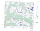
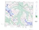
Maps showing Moose Wallow Creek, Cariboo Land District, British Columbia
Moose Wallow Creek is a River located in Cariboo Land District, British Columbia.
- Latitude: 53° 17' 54'' North (decimal: 53.2983333)
- Longitude: 119° 26' 42'' West (decimal: -119.445)
- Topography Feature Category: River
- Geographical Feature: Creek
- Canadian Province/Territory: British Columbia
- Location: Cariboo Land District
- Atlas of Canada Locator Map: Moose Wallow Creek
- GPS Coordinate Locator Map: Moose Wallow Creek Lat/Long
Moose Wallow Creek NTS Map Sheets