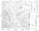
Maps showing Dease River 4, British Columbia
Dease River 4 is a Indian Reserve located in British Columbia.
- Latitude: 59° 33' 42'' North (decimal: 59.5616666)
- Longitude: 129° 13' 14'' West (decimal: -129.2205555)
- Topography Feature Category: Indian Reserve
- Geographical Feature: Indian Reserve - Réserve indienne
- Canadian Province/Territory: British Columbia
- Atlas of Canada Locator Map: Dease River 4
- GPS Coordinate Locator Map: Dease River 4 Lat/Long