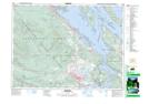
Maps showing Penelakut Island 7, Chemainus Land District, British Columbia
Penelakut Island 7 is a Indian Reserve located in Chemainus Land District, British Columbia.
- Latitude: 48° 57' 47'' North (decimal: 48.9630555)
- Longitude: 123° 38' 46'' West (decimal: -123.6461111)
- Topography Feature Category: Indian Reserve
- Geographical Feature: Indian Reserve - Réserve indienne
- Canadian Province/Territory: British Columbia
- Location: Chemainus Land District
- Atlas of Canada Locator Map: Penelakut Island 7
- GPS Coordinate Locator Map: Penelakut Island 7 Lat/Long