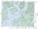
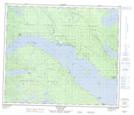
Maps showing Réserve indienne Tsun Tine Ah 37, New Westminster Land District, British Columbia
Réserve indienne Tsun Tine Ah 37 is a Indian Reserve located in New Westminster Land District, British Columbia.
- Latitude: 54° 43' 56'' North (decimal: 54.732222)
- Longitude: 124° 41' 47'' West (decimal: -124.69639)
- Topography Feature Category: Indian Reserve
- Geographical Feature: Réserve indienne
- Canadian Province/Territory: British Columbia
- Location: New Westminster Land District
- Atlas of Canada Locator Map: Réserve indienne Tsun Tine Ah 37
- GPS Coordinate Locator Map: Réserve indienne Tsun Tine Ah 37 Lat/Long
Réserve indienne Tsun Tine Ah 37 NTS Map Sheets