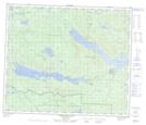
Maps showing Tse Bay Ha Tine A Indian Reserve 34, Range 5 Coast Land District, British Columbia
Tse Bay Ha Tine A Indian Reserve 34 is a Indian Reserve located in Range 5 Coast Land District, British Columbia.
- Latitude: 54° 32' North (decimal: 54.5332999)
- Longitude: 125° 6' West (decimal: -125.0999999)
- Topography Feature Category: Indian Reserve
- Geographical Feature: Indian Reserve
- Canadian Province/Territory: British Columbia
- Location: Range 5 Coast Land District
- Atlas of Canada Locator Map: Tse Bay Ha Tine A Indian Reserve 34
- GPS Coordinate Locator Map: Tse Bay Ha Tine A Indian Reserve 34 Lat/Long
Tse Bay Ha Tine A Indian Reserve 34 NTS Map Sheets