Maps showing O K'Ay Wha Cho Indian Reserve 26, Range 5 Coast Land District, British Columbia
O K'Ay Wha Cho Indian Reserve 26 is a Indian Reserve located in Range 5 Coast Land District, British Columbia.
- Latitude: 54° 56' North (decimal: 54.9333328)
- Longitude: 125° 16' West (decimal: -125.2666698)
- Topography Feature Category: Indian Reserve
- Geographical Feature: Indian Reserve
- Canadian Province/Territory: British Columbia
- Location: Range 5 Coast Land District
- Atlas of Canada Locator Map: O K'Ay Wha Cho Indian Reserve 26
- GPS Coordinate Locator Map: O K'Ay Wha Cho Indian Reserve 26 Lat/Long
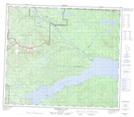
O K'Ay Wha Cho Indian Reserve 26 NTS Map Sheets