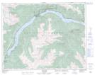
Maps showing Whitecap Indian Reserve 1, Lillooet Land District, British Columbia
Whitecap Indian Reserve 1 is a Indian Reserve located in Lillooet Land District, British Columbia.
- Latitude: 50° 42' 25'' North (decimal: 50.7069440)
- Longitude: 122° 17' 50'' West (decimal: -122.2972199)
- Topography Feature Category: Indian Reserve
- Geographical Feature: Indian Reserve
- Canadian Province/Territory: British Columbia
- Location: Lillooet Land District
- Atlas of Canada Locator Map: Whitecap Indian Reserve 1
- GPS Coordinate Locator Map: Whitecap Indian Reserve 1 Lat/Long