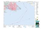
Maps showing Refuge d'oiseaux du havre de Victoria, British Columbia
Refuge d'oiseaux du havre de Victoria is a Conservation area located in British Columbia and has an elevation of 0 meters.
- Latitude: 48° 24' 0'' North (decimal: 48.4000000)
- Longitude: 123° 24' 30'' West (decimal: -123.4083299)
- Topography Feature Category: Conservation area
- Geographical Feature: Refuge d'oiseaux migrateurs
- Canadian Province/Territory: British Columbia
- Elevation: 0 meters
- Atlas of Canada Locator Map: Refuge d'oiseaux du havre de Victoria
- GPS Coordinate Locator Map: Refuge d'oiseaux du havre de Victoria Lat/Long