Canada Topographic Maps

Blackstone Plateau Topo Maps

Topography maps and Latitude/Longitude Location

Maps showing Blackstone Plateau, Yukon

Blackstone Plateau is a Plain located in Yukon.

  • Latitude: 64° 46' 43'' North   (decimal: 64.7786111)
  • Longitude: 138° 29' 36'' West   (decimal: -138.4933333)
  • Topography Feature Category: Plain
  • Geographical Feature: Plateau
  • Canadian Province/Territory: Yukon
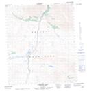
  • Atlas of Canada Locator Map: Blackstone Plateau
  • GPS Coordinate Locator Map: Blackstone Plateau Lat/Long

Blackstone Plateau NTS Map Sheets

116B09 North Fork Pass Topographic Map at 1:50,000 scale

116B10 Seela Pass Topographic Map at 1:50,000 scale

116B14 No Title Topographic Map at 1:50,000 scale

116B15 Kit Lake Topographic Map at 1:50,000 scale

116B16 Lomond Lake Topographic Map at 1:50,000 scale

116B Dawson Topographic Map at 1:250,000 scale

 
Buy Topographic Maps DVD
Newsletter Sign-up

Yes, I want to receive map store discounts.


Bookmark and Share