Canada Topographic Maps

Boundary Creek Topo Maps

Topography maps and Latitude/Longitude Location

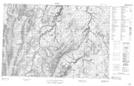
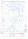
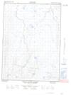
Maps showing Boundary Creek, Yukon

Boundary Creek is a River located in Yukon.

  • Latitude: 68° 30' 3'' North   (decimal: 68.5008333)
  • Longitude: 136° 27' 29'' West   (decimal: -136.4580556)
  • Topography Feature Category: River
  • Geographical Feature: Creek
  • Canadian Province/Territory: Yukon
  • Atlas of Canada Locator Map: Boundary Creek
  • GPS Coordinate Locator Map: Boundary Creek Lat/Long

Boundary Creek NTS Map Sheets

117A08 No Title Topographic Map at 1:50,000 scale

117A09E Mount Davies Gilbert Topographic Map at 1:50,000 scale

117A09W Mount Davies Gilbert Topographic Map at 1:50,000 scale

117A Blow River Topographic Map at 1:250,000 scale

 
Buy Topographic Maps DVD
Newsletter Sign-up

Yes, I want to receive map store discounts.


Bookmark and Share