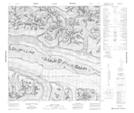
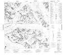
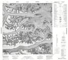
Maps showing Centennial Range, Yukon
Centennial Range is a Mountain located in Yukon and has an elevation of 1856 meters.
- Latitude: 60° 58' 46'' North (decimal: 60.9794444)
- Longitude: 140° 42' 5'' West (decimal: -140.7013889)
- Topography Feature Category: Mountain
- Geographical Feature: Range
- Canadian Province/Territory: Yukon
- Elevation: 1856 meters
- Atlas of Canada Locator Map: Centennial Range
- GPS Coordinate Locator Map: Centennial Range Lat/Long
Centennial Range NTS Map Sheets
115C Map Not Available Topographic Map at 1:250,000 scale
115F Map Not Available Topographic Map at 1:250,000 scale
