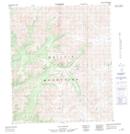
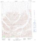
Maps showing Chandindu River, Yukon
Chandindu River is a River located in Yukon and has an elevation of 469 meters.
- Latitude: 64° 15' 7'' North (decimal: 64.2519444)
- Longitude: 139° 43' 1'' West (decimal: -139.7169444)
- Topography Feature Category: River
- Geographical Feature: River
- Canadian Province/Territory: Yukon
- Elevation: 469 meters
- Atlas of Canada Locator Map: Chandindu River
- GPS Coordinate Locator Map: Chandindu River Lat/Long
Chandindu River NTS Map Sheets
116B05 Fifteenmile River Topographic Map at 1:50,000 scale
116B06 Chandindu River Topographic Map at 1:50,000 scale
116B07 Tombstone River Topographic Map at 1:50,000 scale
116B10 Seela Pass Topographic Map at 1:50,000 scale
116B11 No Title Topographic Map at 1:50,000 scale
116B14 No Title Topographic Map at 1:50,000 scale
116B Dawson Topographic Map at 1:250,000 scale