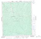
Maps showing Chief Gulch, Yukon
Chief Gulch is a Valley located in Yukon and has an elevation of 700 meters.
- Latitude: 63° 51' 17'' North (decimal: 63.8547222)
- Longitude: 139° 15' 11'' West (decimal: -139.2530556)
- Topography Feature Category: Valley
- Geographical Feature: Gulch
- Canadian Province/Territory: Yukon
- Elevation: 700 meters
- Atlas of Canada Locator Map: Chief Gulch
- GPS Coordinate Locator Map: Chief Gulch Lat/Long
Chief Gulch NTS Map Sheets