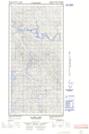
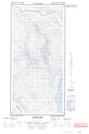
Maps showing Claire Lake, Yukon
Claire Lake is a Lake located in Yukon and has an elevation of 656 meters.
- Latitude: 61° 52' 44'' North (decimal: 61.8788888)
- Longitude: 135° 20' 23'' West (decimal: -135.3397221)
- Topography Feature Category: Lake
- Geographical Feature: Lake
- Canadian Province/Territory: Yukon
- Elevation: 656 meters
- Atlas of Canada Locator Map: Claire Lake
- GPS Coordinate Locator Map: Claire Lake Lat/Long
Claire Lake NTS Map Sheets