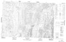
Maps showing Mount Close, Yukon
Mount Close is a Mountain located in Yukon and has an elevation of 1060 meters.
- Latitude: 68° 19' 57'' North (decimal: 68.3325)
- Longitude: 137° 24' 38'' West (decimal: -137.4105556)
- Topography Feature Category: Mountain
- Geographical Feature: Mount
- Canadian Province/Territory: Yukon
- Elevation: 1060 meters
- Atlas of Canada Locator Map: Mount Close
- GPS Coordinate Locator Map: Mount Close Lat/Long
Mount Close NTS Map Sheets