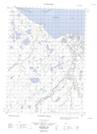
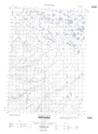
Maps showing Conglomerate Creek, Yukon
Conglomerate Creek is a River located in Yukon.
- Latitude: 68° 54' 28'' North (decimal: 68.9077777)
- Longitude: 137° 41' 4'' West (decimal: -137.6844444)
- Topography Feature Category: River
- Geographical Feature: Creek
- Canadian Province/Territory: Yukon
- Atlas of Canada Locator Map: Conglomerate Creek
- GPS Coordinate Locator Map: Conglomerate Creek Lat/Long
Conglomerate Creek NTS Map Sheets