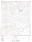
Maps showing Conservative Trail, Yukon
Conservative Trail is a Road feature located in Yukon and has an elevation of 769 meters.
- Latitude: 63° 40' North (decimal: 63.6666666)
- Longitude: 136° 25' West (decimal: -136.4166667)
- Topography Feature Category: Road feature
- Geographical Feature: Trail
- Canadian Province/Territory: Yukon
- Elevation: 769 meters
- Atlas of Canada Locator Map: Conservative Trail
- GPS Coordinate Locator Map: Conservative Trail Lat/Long
Conservative Trail NTS Map Sheets