Canada Topographic Maps

Cuesta Creek Topo Maps

Topography maps and Latitude/Longitude Location

Maps showing Cuesta Creek, Yukon

Cuesta Creek is a River located in Yukon.

  • Latitude: 68° 45' 9'' North   (decimal: 68.7525)
  • Longitude: 136° 54' 6'' West   (decimal: -136.9016667)
  • Topography Feature Category: River
  • Geographical Feature: Creek
  • Canadian Province/Territory: Yukon
  • Atlas of Canada Locator Map: Cuesta Creek
  • GPS Coordinate Locator Map: Cuesta Creek Lat/Long

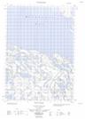
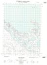
Cuesta Creek NTS Map Sheets

117A09E Mount Davies Gilbert Topographic Map at 1:50,000 scale

117A09W Mount Davies Gilbert Topographic Map at 1:50,000 scale

117A10E Anker Creek Topographic Map at 1:50,000 scale

117A10W Anker Creek Topographic Map at 1:50,000 scale

117A16E Tent Island Topographic Map at 1:50,000 scale

117A16W Tent Island Topographic Map at 1:50,000 scale

117A Blow River Topographic Map at 1:250,000 scale

 
Buy Topographic Maps DVD
Newsletter Sign-up

Yes, I want to receive map store discounts.


Bookmark and Share