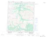
Maps showing East O'Brien Creek, Yukon
East O'Brien Creek is a River located in Yukon and has an elevation of 619 meters.
- Latitude: 64° 4' 35'' North (decimal: 64.0763888)
- Longitude: 137° 57' 46'' West (decimal: -137.9627778)
- Topography Feature Category: River
- Geographical Feature: Creek
- Canadian Province/Territory: Yukon
- Elevation: 619 meters
- Atlas of Canada Locator Map: East O'Brien Creek
- GPS Coordinate Locator Map: East O'Brien Creek Lat/Long
East O'Brien Creek NTS Map Sheets