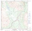
Maps showing Flat Top Mountain, Yukon
Flat Top Mountain is a Mountain located in Yukon and has an elevation of 1766 meters.
- Latitude: 61° 47' 8'' North (decimal: 61.7855555)
- Longitude: 140° 57' 1'' West (decimal: -140.9502778)
- Topography Feature Category: Mountain
- Geographical Feature: Mountain
- Canadian Province/Territory: Yukon
- Elevation: 1766 meters
- Atlas of Canada Locator Map: Flat Top Mountain
- GPS Coordinate Locator Map: Flat Top Mountain Lat/Long
Flat Top Mountain NTS Map Sheets
115F Map Not Available Topographic Map at 1:250,000 scale
