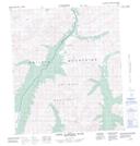
Maps showing Fold Creek, Yukon
Fold Creek is a River located in Yukon and has an elevation of 1167 meters.
- Latitude: 64° 30' 18'' North (decimal: 64.505)
- Longitude: 138° 18' 37'' West (decimal: -138.3102778)
- Topography Feature Category: River
- Geographical Feature: Creek
- Canadian Province/Territory: Yukon
- Elevation: 1167 meters
- Atlas of Canada Locator Map: Fold Creek
- GPS Coordinate Locator Map: Fold Creek Lat/Long
Fold Creek NTS Map Sheets

116C Map Not Available Topographic Map at 1:250,000 scale
