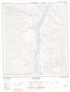
Maps showing Garner Creek, Yukon
Garner Creek is a River located in Yukon and has an elevation of 483 meters.
- Latitude: 63° 55' 9'' North (decimal: 63.9191666)
- Longitude: 139° 44' 21'' West (decimal: -139.7391667)
- Topography Feature Category: River
- Geographical Feature: Creek
- Canadian Province/Territory: Yukon
- Elevation: 483 meters
- Atlas of Canada Locator Map: Garner Creek
- GPS Coordinate Locator Map: Garner Creek Lat/Long
Garner Creek NTS Map Sheets