Canada Topographic Maps

Hungry Creek Topo Maps

Topography maps and Latitude/Longitude Location

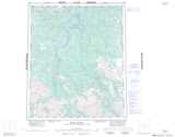
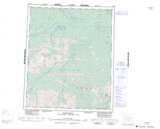
Maps showing Hungry Creek, Yukon

Hungry Creek is a River located in Yukon and has an elevation of 357 meters.

  • Latitude: 65° 35' 27'' North   (decimal: 65.5908333)
  • Longitude: 135° 28' 1'' West   (decimal: -135.4669444)
  • Topography Feature Category: River
  • Geographical Feature: Creek
  • Canadian Province/Territory: Yukon
  • Elevation: 357 meters
  • Atlas of Canada Locator Map: Hungry Creek
  • GPS Coordinate Locator Map: Hungry Creek Lat/Long

Hungry Creek NTS Map Sheets

106E11 No Title Topographic Map at 1:50,000 scale

106E12 Bear Lake Topographic Map at 1:50,000 scale

116H08 Mount Turner Topographic Map at 1:50,000 scale

116H09 Hungry Lake Topographic Map at 1:50,000 scale

106E Wind River Topographic Map at 1:250,000 scale

116H Hart River Topographic Map at 1:250,000 scale

 
Buy Topographic Maps DVD
Newsletter Sign-up

Yes, I want to receive map store discounts.


Bookmark and Share