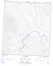
Maps showing Ice Chest Reef, Yukon
Ice Chest Reef is a Shoal located in Yukon.
- Latitude: 63° 36' 17'' North (decimal: 63.6047222)
- Longitude: 137° 47' 17'' West (decimal: -137.7880556)
- Topography Feature Category: Shoal
- Geographical Feature: Reef
- Canadian Province/Territory: Yukon
- Atlas of Canada Locator Map: Ice Chest Reef
- GPS Coordinate Locator Map: Ice Chest Reef Lat/Long
Ice Chest Reef NTS Map Sheets