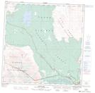
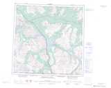
Maps showing Kloo Lake, Yukon
Kloo Lake is a Lake located in Yukon and has an elevation of 854 meters.
- Latitude: 60° 57' 29'' North (decimal: 60.9580555)
- Longitude: 137° 51' 46'' West (decimal: -137.8627778)
- Topography Feature Category: Lake
- Geographical Feature: Lake
- Canadian Province/Territory: Yukon
- Elevation: 854 meters
- Atlas of Canada Locator Map: Kloo Lake
- GPS Coordinate Locator Map: Kloo Lake Lat/Long
Kloo Lake NTS Map Sheets