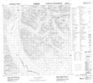
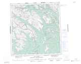
Maps showing Mount Laporte, Yukon
Mount Laporte is a Mountain located in Yukon.
- Latitude: 61° 13' 20'' North (decimal: 61.2222222)
- Longitude: 127° 42' 29'' West (decimal: -127.7080556)
- Topography Feature Category: Mountain
- Geographical Feature: Mount
- Canadian Province/Territory: Yukon
- Atlas of Canada Locator Map: Mount Laporte
- GPS Coordinate Locator Map: Mount Laporte Lat/Long
Mount Laporte NTS Map Sheets