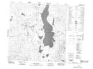
Maps showing Leaf Lake, Yukon
Leaf Lake is a Lake located in Yukon and has an elevation of 955 meters.
- Latitude: 60° 42' 9'' North (decimal: 60.7025)
- Longitude: 131° 53' 25'' West (decimal: -131.8902778)
- Topography Feature Category: Lake
- Geographical Feature: Lake
- Canadian Province/Territory: Yukon
- Elevation: 955 meters
- Atlas of Canada Locator Map: Leaf Lake
- GPS Coordinate Locator Map: Leaf Lake Lat/Long
Leaf Lake NTS Map Sheets