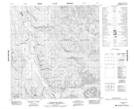
Maps showing Little Violet Creek, Yukon
Little Violet Creek is a River located in Yukon and has an elevation of 842 meters.
- Latitude: 61° 24' 53'' North (decimal: 61.4147222)
- Longitude: 134° 22' 49'' West (decimal: -134.3802778)
- Topography Feature Category: River
- Geographical Feature: Creek
- Canadian Province/Territory: Yukon
- Elevation: 842 meters
- Atlas of Canada Locator Map: Little Violet Creek
- GPS Coordinate Locator Map: Little Violet Creek Lat/Long
Little Violet Creek NTS Map Sheets