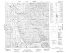
Maps showing Livingstone, Yukon
Livingstone is a Unincorporated area located in Yukon and has an elevation of 912 meters.
- Latitude: 61° 20' 25'' North (decimal: 61.3402777)
- Longitude: 134° 20' 52'' West (decimal: -134.3477778)
- Topography Feature Category: Unincorporated area
- Geographical Feature: Settlement
- Canadian Province/Territory: Yukon
- Elevation: 912 meters
- Atlas of Canada Locator Map: Livingstone
- GPS Coordinate Locator Map: Livingstone Lat/Long
Livingstone NTS Map Sheets