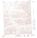
Maps showing North Fork Pass, Yukon
North Fork Pass is a Valley located in Yukon and has an elevation of 1335 meters.
- Latitude: 64° 34' 6'' North (decimal: 64.5683333)
- Longitude: 138° 15' 30'' West (decimal: -138.2583333)
- Topography Feature Category: Valley
- Geographical Feature: Pass
- Canadian Province/Territory: Yukon
- Elevation: 1335 meters
- Atlas of Canada Locator Map: North Fork Pass
- GPS Coordinate Locator Map: North Fork Pass Lat/Long
North Fork Pass NTS Map Sheets