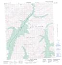
Maps showing Pack Saddle Pass, Yukon
Pack Saddle Pass is a Valley located in Yukon.
- Latitude: 64° 24' 33'' North (decimal: 64.4091666)
- Longitude: 138° 6' 43'' West (decimal: -138.1119444)
- Topography Feature Category: Valley
- Geographical Feature: Pass
- Canadian Province/Territory: Yukon
- Atlas of Canada Locator Map: Pack Saddle Pass
- GPS Coordinate Locator Map: Pack Saddle Pass Lat/Long
Pack Saddle Pass NTS Map Sheets