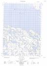
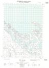
Maps showing Pillage Point, Yukon
Pillage Point is a Cape located in Yukon.
- Latitude: 68° 51' 35'' North (decimal: 68.8597222)
- Longitude: 136° 42' 36'' West (decimal: -136.71)
- Topography Feature Category: Cape
- Geographical Feature: Point
- Canadian Province/Territory: Yukon
- Atlas of Canada Locator Map: Pillage Point
- GPS Coordinate Locator Map: Pillage Point Lat/Long
Pillage Point NTS Map Sheets