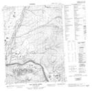
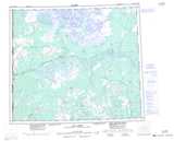
Maps showing Rat Indian Creek, Yukon
Rat Indian Creek is a River located in Yukon and has an elevation of 296 meters.
- Latitude: 67° 33' 46'' North (decimal: 67.5627777)
- Longitude: 138° 20' 27'' West (decimal: -138.3408333)
- Topography Feature Category: River
- Geographical Feature: Creek
- Canadian Province/Territory: Yukon
- Elevation: 296 meters
- Atlas of Canada Locator Map: Rat Indian Creek
- GPS Coordinate Locator Map: Rat Indian Creek Lat/Long
Rat Indian Creek NTS Map Sheets